Photogrammetry and LiDAR are two of the most important technologies in drone mapping. They can both be used to create 3D data, maps and models, but they work in very different ways.
Photogrammetry uses overlapping photographs. LiDAR uses laser measurements.
That simple difference affects almost everything: cost, equipment, accuracy, vegetation performance, file outputs, workflow, software, training requirements and the kind of jobs each method suits.
For most people starting out in drone mapping, photogrammetry is the better place to begin. It is more accessible, cheaper to learn and produces strong visual outputs such as orthomosaics, 3D models and textured site records. LiDAR is more specialist. It becomes more valuable when the job needs dense 3D data, better terrain capture, vegetation penetration or high-value survey workflows.
This guide explains the difference clearly so you can understand which technology makes sense for different drone mapping jobs.
Table of Contents
ToggleQuick Answer: Photogrammetry vs LiDAR
Photogrammetry creates maps and 3D models from overlapping images.
LiDAR creates 3D point clouds using laser pulses.
For most beginner drone mapping, photogrammetry is the better starting point because it can be done with more affordable camera drones and produces visually rich outputs. LiDAR is better for specialist work where terrain, structure, vegetation, corridors or high-density 3D data matter more than visual texture.
| Feature | Photogrammetry | LiDAR |
|---|---|---|
| Data source | Overlapping photos | Laser measurements |
| Main output | Orthomosaics, 3D models, point clouds | Dense point clouds, elevation and structure data |
| Entry cost | Lower | Much higher |
| Visual detail | Strong | Often needs RGB colourisation |
| Vegetation | Can struggle | Usually better |
| Textureless surfaces | Can struggle | Usually better |
| Typical users | Mapping beginners, construction, visual site records | Survey, forestry, infrastructure, terrain, corridors |
| Learning curve | Easier to start | More specialist |
| Best first step | Yes | Usually later |
The short version: start with photogrammetry, learn LiDAR when the job demands it.
What Is Photogrammetry?
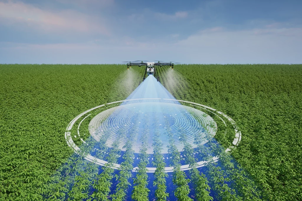
Photogrammetry is the process of taking overlapping photographs and using software to reconstruct measurements, maps and 3D models from those images.
In drone mapping, the drone flies over a site in a planned pattern and captures many images. Each image overlaps with the next one. Mapping software then identifies matching features across the photographs and uses them to reconstruct the scene.
The result might be an orthomosaic map, 3D model, point cloud, digital surface model, contour map or volume calculation.
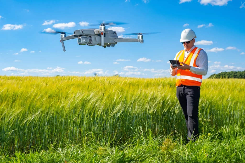
Photogrammetry is popular because it can be done with many camera drones. You do not need a specialist LiDAR payload to start learning how drone mapping works. A suitable camera drone, proper overlap, consistent flight planning and good processing software can produce useful outputs.
What Is LiDAR?
LiDAR stands for Light Detection and Ranging.
A LiDAR sensor emits pulses of light and measures how long they take to return after hitting objects or surfaces. These measurements are used to create a 3D point cloud.
In drone mapping, a LiDAR sensor is mounted on a drone and collects distance measurements as the drone flies. The system usually combines laser data with positioning and motion data from GNSS, IMU and other sensors.
LiDAR is especially useful where photogrammetry struggles. It can capture accurate 3D structure, work better with some textureless surfaces and, depending on conditions and equipment, capture ground information through gaps in vegetation.
LiDAR is more expensive and more specialist than photogrammetry. The hardware, software, processing and interpretation all require a higher level of knowledge.
How Photogrammetry Works
Photogrammetry depends on image overlap.
The drone captures a sequence of photographs from different positions. Each photo contains some of the same features as the photos before and after it. The software finds matching points between the images and uses those matches to calculate camera positions and reconstruct the scene.
A typical photogrammetry workflow includes:
- Define the mapping area.
- Plan a flight with enough front and side overlap.
- Capture clear, consistent images.
- Process the images in mapping software.
- Generate outputs such as an orthomosaic, 3D model or point cloud.
- Check the output for gaps, distortion and alignment issues.
Good photogrammetry depends on several things: image sharpness, lighting, overlap, camera quality, flight height, ground texture, positioning accuracy and processing settings.
The better the data capture, the better the output.
How LiDAR Works
LiDAR works by measuring distance with light.
The sensor sends out laser pulses. Those pulses hit objects such as the ground, trees, buildings, roofs, powerlines or vegetation, then return to the sensor. The system measures the time taken for each pulse to return and uses that to calculate distance.
As the drone moves, the LiDAR sensor collects many measurements. These measurements form a point cloud.
A drone LiDAR workflow usually includes:
- Choose the correct drone and LiDAR payload.
- Plan the flight route and altitude.
- Calibrate the sensor and system where required.
- Capture LiDAR data during the flight.
- Process the point cloud.
- Clean, classify or colourise the data where needed.
- Export outputs for CAD, GIS, modelling or analysis.
LiDAR can be very powerful, but it is not magic. It still needs good positioning, correct workflow, suitable processing and skilled interpretation.
Photogrammetry vs LiDAR: Main Differences
The main difference is the data source.
Photogrammetry uses images. LiDAR uses laser measurements.
Because photogrammetry uses images, it creates strong visual outputs. Orthomosaics and textured 3D models are often easier for clients and beginners to understand.
Because LiDAR uses laser measurements, it is often stronger for 3D structure and terrain-focused work. It can be especially valuable where visual images alone do not give enough reliable geometry.
The right choice depends on the job. A construction progress map may be perfectly suited to photogrammetry. A forestry terrain model or powerline corridor survey may be better suited to LiDAR.
Cost Difference
Photogrammetry is usually much cheaper to start with.
You can learn the basics with a suitable camera drone and mapping software. The drone still needs to be capable enough for the job, but the entry point is much more accessible than LiDAR.
LiDAR systems are expensive. You need a compatible drone platform, LiDAR payload, positioning hardware, software and the knowledge to process and interpret the data properly.
This is why photogrammetry is the normal starting point for many drone mapping beginners. It lets you learn the principles of flight planning, overlap, processing and output quality without immediately spending enterprise-drone money.
LiDAR becomes easier to justify when the work is valuable enough, technical enough or difficult enough that photogrammetry is not the best tool.
Accuracy Difference
Both photogrammetry and LiDAR can produce accurate outputs, but accuracy depends on the workflow.
It is too simplistic to say “LiDAR is accurate and photogrammetry is not”. A well-planned photogrammetry job with good control can be more useful than a poorly executed LiDAR job.
Accuracy depends on:
- sensor quality
- flight planning
- GNSS quality
- RTK or PPK use
- ground control points
- lighting and surface detail
- image overlap
- processing settings
- calibration
- operator skill
- how the output is checked
LiDAR often has advantages in specialist 3D and terrain workflows, but it still requires proper positioning and processing.
Photogrammetry can be accurate enough for many mapping uses, especially visual site records, construction progress, orthomosaics and some measurement workflows. The key is understanding what accuracy is actually required.
Vegetation and Ground Detail
Vegetation is one of the biggest reasons people consider LiDAR.
Photogrammetry reconstructs what the camera can see. If dense grass, scrub, brambles, tree canopies or crops hide the ground, photogrammetry may struggle to model the true ground surface.
LiDAR can sometimes capture returns through gaps in vegetation, making it better suited to terrain modelling in wooded or vegetated areas. It is not guaranteed to see through every canopy, but it is often much more useful than imagery alone for vegetation-heavy sites.
This is why LiDAR is valuable in forestry, flood modelling, utilities, corridors, land surveying and environmental work.
If the job is mainly a clear construction site or open hardstanding, photogrammetry may be enough. If the job involves ground levels under vegetation, LiDAR becomes much more interesting.
3D Models and Point Clouds
Both photogrammetry and LiDAR can create point clouds, but the character of those point clouds is different.
Photogrammetry point clouds are derived from matching points in overlapping images. They can be visually rich when textured and colourised because they come from photographs.
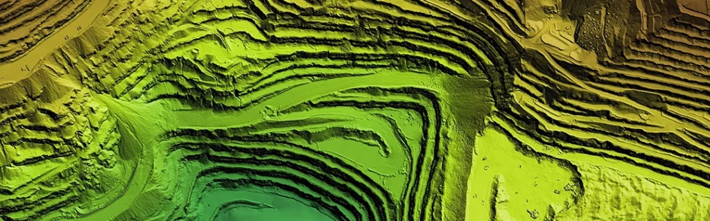
LiDAR point clouds are created from direct laser measurements. They can be denser and more reliable for certain 3D structures, terrain and vegetation-related workflows.
A photogrammetry 3D model is often easier to present visually. A LiDAR point cloud may be more useful technically.
The right output depends on who is using it. A client looking at a roof or building may prefer a textured 3D model. A surveyor or engineer may care more about the quality and structure of the point cloud.
Orthomosaics and Visual Mapping
Photogrammetry is usually the stronger choice for orthomosaics and visual mapping.
An orthomosaic is a corrected 2D map made from many overlapping images. It is useful because it looks like a detailed aerial map but has been processed to reduce perspective distortion and make it more useful for measurement.
This is one of photogrammetry’s biggest strengths.
If the client needs a clear visual record of a construction site, field, estate, roof, access route or property, photogrammetry often makes sense. The output is easy to understand and visually useful.
LiDAR can be colourised or combined with RGB imagery, but if the primary deliverable is a detailed visual map, photogrammetry is often the more natural fit.
 What Is a Drone Orthomosaic?
Terrain and Elevation Models
LiDAR is often stronger for terrain and elevation workflows, especially where vegetation is involved.
Photogrammetry can create digital surface models and elevation outputs, but it may struggle to separate the ground from vegetation if the camera cannot see the ground clearly.
LiDAR can capture multiple returns from a surface, which can help with terrain modelling in some environments. This is one reason LiDAR is widely associated with forestry, flood modelling, corridors and land surveying.
That said, a bare, open site with good visual texture may be very suitable for photogrammetry. The job requirements matter more than choosing one technology as automatically superior.
Textureless and Reflective Surfaces
Photogrammetry needs visible features to match between images.
That means it can struggle with surfaces that are plain, repetitive, shiny or textureless. Examples might include blank walls, smooth roofs, reflective surfaces, water, glass, polished concrete or uniform materials.
LiDAR can perform better in some of these situations because it is measuring distance rather than relying on image matching. However, LiDAR also has its own limitations, and reflective or absorbent materials can still cause problems depending on the sensor and conditions.
The practical point is simple: if the surface gives the software little visual information to match, photogrammetry may struggle.
When Photogrammetry Is Better
Photogrammetry is usually better when the job needs strong visual outputs at a more accessible cost.
It is well suited to:
- orthomosaic maps
- construction progress records
- site documentation
- roof and building visual inspections
- 3D models for presentation
- land and estate mapping
- stockpile measurement on open sites
- agricultural visual monitoring
- planning context
- heritage documentation
Photogrammetry is also better for beginners because it teaches the foundations of drone mapping without requiring LiDAR hardware.
If the site is visually clear, well lit and not heavily obstructed by vegetation, photogrammetry can be extremely useful.
When LiDAR Is Better
LiDAR is usually better when the job needs specialist 3D data, terrain information or better performance around vegetation and complex structures.
It is well suited to:
- forestry
- vegetation-heavy sites
- powerline corridors
- railway and road corridors
- complex infrastructure
- terrain modelling
- flood and drainage modelling
- utility mapping
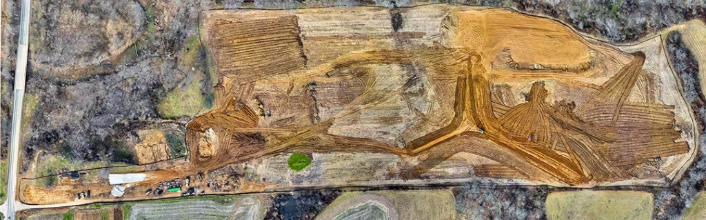
- quarry and earthworks analysis
- specialist survey workflows
- high-value mapping where equipment cost is justified
LiDAR is not the natural starting point for every drone operator. It is the tool you move towards when the job demands it.
If the work is valuable, technical or difficult for photogrammetry, LiDAR may be the better option.
Can You Use Photogrammetry and LiDAR Together?
Yes. In some professional workflows, photogrammetry and LiDAR can complement each other.
LiDAR can provide strong 3D structure and terrain data. RGB imagery can add colour, context and visual detail. Some systems combine LiDAR with an RGB mapping camera, allowing point clouds to be colourised and outputs to be easier to interpret.
This is why some enterprise payloads combine LiDAR, IMU and RGB camera hardware. The aim is not always to choose one method forever. It is to choose the right data capture method for the deliverable.
For serious drone mapping, understanding how these technologies complement each other is more useful than treating them as rivals.
What Should Beginners Learn First?
Most beginners should learn photogrammetry first.
There are three reasons.
First, it is more accessible. You can understand the principles of mapping with a camera drone and suitable software.
Second, it teaches the core workflow: flight planning, overlap, image quality, processing, outputs and accuracy checks.
Third, many drone mapping jobs can be understood through photogrammetry before moving into more specialist sensors.
Once you understand photogrammetry, LiDAR makes more sense. You can better understand why a laser-based system might be needed, what problem it solves, and why it costs more.
The best learning path is:
- Learn basic drone mapping.
- Understand photogrammetry.
- Learn orthomosaics and point clouds.
- Understand RTK, PPK and ground control.
- Then learn LiDAR and specialist sensors.
Drone Mapping Explained for UK Beginners
Which Is Better for Construction Mapping?
For many construction sites, photogrammetry is a strong starting point.
It can create orthomosaics, progress maps, 3D models, stockpile measurements and visual records. It is useful for comparing site progress over time and communicating changes to clients or teams.
LiDAR becomes more relevant when the site requires more detailed 3D data, complex structure capture, terrain modelling or higher-value survey-style deliverables.
For general construction progress mapping, photogrammetry often gives the clearest value. For technical survey workflows, LiDAR may be worth considering.
Which Is Better for Roof Inspections?
For many roof inspections, photogrammetry or normal high-resolution drone imagery is usually the more natural starting point.
Roof inspections often need clear visual detail: tiles, flashing, gutters, valleys, chimneys, flat roof surfaces, skylights and defects. Photogrammetry can also help create 3D context where needed.
LiDAR may be useful for more specialist building modelling or structural context, but it is not usually the first thing most people need for basic roof inspection imagery.
Thermal imaging is a separate topic and can be valuable for certain building and solar inspection workflows, but it should not be confused with LiDAR.
Drone Roof Inspections Explained
Which Is Better for Forestry and Vegetation?
LiDAR is usually stronger for forestry and vegetation-heavy mapping.
Photogrammetry sees the visible canopy and surface texture. If the ground is hidden, the camera cannot reconstruct what it cannot see.
LiDAR can often collect returns through gaps in vegetation, making it more useful for terrain modelling, canopy structure and woodland-related workflows.
This is one of the clearest cases where LiDAR can justify its cost.
Which Is Better for Stockpile Measurement?
Both can be used, depending on the site.
For open stockpiles with good visibility and surface texture, photogrammetry can be very useful. It can produce 3D models and volume measurements at a more accessible cost.
LiDAR may be useful where the site is more complex, the material surface causes problems, the required accuracy is higher, or the workflow already uses LiDAR for other reasons.
The key is not just the sensor. It is the workflow, control and accuracy checks behind the measurement.
Which Is Better for Powerlines and Infrastructure?
LiDAR is often the stronger option for powerlines, corridors and complex infrastructure.
Thin structures, vegetation, terrain and corridor complexity can make LiDAR valuable. Powerline and utility work also often involves higher-value professional workflows where specialist equipment is easier to justify.
Photogrammetry can still be useful for visual inspection, context and documentation, but LiDAR is often better suited to detailed 3D corridor mapping.
UK Drone Rules and Professional Use
The technology is only one part of the decision.
In the UK, the type of drone work, location, risk level and operating environment all matter. Some simple drone operations may fall under the Open Category, but more complex work may require Specific Category authorisation, suitable procedures, insurance, permissions and proper risk assessment.
This is especially relevant for professional mapping, inspection and commercial data capture.
This article is for general technical information, not legal advice. Always check current UK CAA guidance and make sure the operation is planned, authorised and insured where required.
Equipment Cost and Business Reality
LiDAR gets attention because it sounds advanced, but the cost matters.
A photogrammetry setup can start with a capable camera drone, suitable software and a good workflow. A LiDAR setup usually involves enterprise-level drone hardware, a specialist payload, processing software and more technical training.
That means LiDAR is not something most people buy just because it is better on paper. It has to match the work.
If your jobs are visual mapping, construction progress, basic site records or roof imagery, photogrammetry may be enough. If your work involves vegetation, terrain, corridors, forestry or specialist 3D deliverables, LiDAR may become worthwhile.
Serious drone buyers should start with the output they need, not the sensor they find most interesting.
Common Mistakes When Comparing Photogrammetry and LiDAR
Thinking LiDAR Is Always Better
LiDAR is powerful, but it is not automatically better for every job. If the client needs a visual map or textured model, photogrammetry may be the better fit.
Thinking Photogrammetry Is Just Photos
Photogrammetry is not random aerial photography. It is a structured mapping workflow based on overlap, positioning, processing and quality control.
Ignoring the Final Output
The right technology depends on the deliverable. Orthomosaic, point cloud, terrain model, inspection report and volume calculation may all require different choices.
Forgetting About Software
The sensor is only part of the workflow. Processing software, export formats and quality checks matter just as much.
Overclaiming Accuracy
This is a serious risk. A good-looking map is not automatically suitable for measurement or survey work. Accuracy must be understood and checked.
Buying Equipment Before Understanding the Workflow
Do not buy LiDAR because it sounds impressive. Understand the jobs, outputs, clients, rules and processing requirements first.
Final Verdict: Photogrammetry vs LiDAR
Photogrammetry is usually the best starting point for drone mapping.
It is more accessible, more affordable and excellent for visual outputs such as orthomosaics, 3D models, construction progress maps, roof records and site documentation.
LiDAR is more specialist. It is better suited to high-value 3D data capture, terrain modelling, vegetation-heavy sites, forestry, corridors, utilities and survey-style workflows where laser measurement gives a clear advantage.
The best choice depends on the job.
If you are learning drone mapping, start with photogrammetry. If you are moving into specialist survey, terrain, infrastructure or vegetation work, learn where LiDAR adds value.
The important thing is not to choose the most impressive technology. It is to choose the right tool for the output.
FAQ
What is the difference between photogrammetry and LiDAR?
Photogrammetry uses overlapping photographs to create maps and models. LiDAR uses laser measurements to create 3D point clouds and other spatial data.
Is LiDAR better than photogrammetry?
Not always. LiDAR is better for some specialist 3D, terrain and vegetation workflows, but photogrammetry is often better for visual mapping, orthomosaics and more accessible drone mapping.
Is photogrammetry cheaper than LiDAR?
Yes. Photogrammetry is usually much cheaper to start with because it can be done with a suitable camera drone and mapping software. LiDAR usually requires specialist sensors and enterprise-level workflows.
Can photogrammetry create point clouds?
Yes. Photogrammetry can create point clouds from overlapping images, although they are generated differently from LiDAR point clouds.
Can LiDAR create orthomosaics?
LiDAR itself creates point cloud data, not a normal photo-based orthomosaic. However, LiDAR systems may be combined with RGB cameras to add visual context or colourise point clouds.
Which is better for drone mapping beginners?
Photogrammetry is usually better for beginners because it is more affordable, easier to understand and teaches the core mapping workflow.
Which is better for mapping through trees?
LiDAR is usually better for vegetation-heavy areas because it can capture returns through gaps in vegetation. Photogrammetry mainly reconstructs what the camera can see.
Which is better for construction sites?
Photogrammetry is often enough for construction progress mapping, orthomosaics, 3D models and visual records. LiDAR may be better for more technical 3D or survey-style construction workflows.
Which is better for roof inspections?
Photogrammetry and high-resolution drone imagery are usually the better starting points for roof inspections. LiDAR may be useful for more specialist building modelling, but it is not usually needed for basic visual roof inspection.
Which is better for stockpile measurement?
Both can work. Photogrammetry is often suitable for open stockpiles with good visibility and texture. LiDAR may be useful for more complex sites or higher-value workflows.
Do you need RTK or PPK for photogrammetry?
Not always, but RTK or PPK can improve positioning accuracy. Ground control points and accuracy checks may still be needed depending on the job.
Do you need RTK or PPK for LiDAR?
LiDAR systems usually rely heavily on accurate positioning and motion data, so GNSS, IMU, RTK or PPK workflows are often important.
Should I learn LiDAR first?
No. Most people should learn photogrammetry first, then move into LiDAR once they understand mapping workflows, outputs, accuracy and where laser data adds value.
Is LiDAR worth it for drone operators?
LiDAR can be worth it for specialist professional work, especially terrain, forestry, utilities, corridors and high-value survey-style projects. It is not usually worth it for basic beginner mapping or simple visual inspections.
Can photogrammetry and LiDAR be used together?
Yes. Some professional workflows combine LiDAR with RGB imagery to create stronger outputs, colourised point clouds and more complete mapping datasets.